2009 turned out to be a year of amazing weather extremes - hot and cold, wet and dry with many records being set along the way. Here are some of the weather highlights for 2009 with great photographs supplied by viewers of The Weather Channel.
* During January and February, widespread heavy rain fell across north-western Queensland, producing extensive flooding around the Mt. Isa and Cloncurry areas. Flood-waters travelled southwards into Lake Eyre over the following weeks.
The Copperfield River, Queensland, in flood. Photo by Cindy and Damien (click to enlarge)
* A record-breaking heat- wave began building across south-eastern Australia during January and early February. During this time many temperature records were broken in South Australia, Victoria, Tasmania and southern NSW.
Tasmania recorded its highest ever temperature on 30th January (Scamander 42.2C).
On 7th February Victoria’s highest ever temperature was registered at Hopetoun at 48.8C and Melbourne’s new temperature record was raised to 46.4C on the same day.
Numerous deaths attributed to the heat were reported and morgues in Melbourne and Adelaide were filled to capacity because of the spike in heat related deaths. In Melbourne alone it’s estimated that more that 350 people died as a direct result of the heat during the scorching days of the 28th, 29th and 30th January, when maximum temperatures climbed above 43C on each day.
* Disastrous bushfires erupted across parts of central Victoria on Saturday 7th February – the Black Saturday fires - with 173 lives lost and more than 1800 houses razed. These were the worst fires in Australian history.
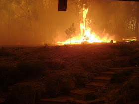
Black Saturday fires rage across Victoria. Photograph from Wikipedia Commons. (Daniel Cleavely)
(Click to enlarge)
* An east coast low dumped heavy rain along the NSW coastal areas between Kempsey and Newcastle on Tuesday 17th February, generating further floods across the already saturated Bellinger River catchment. The town of Bellingen was totally isolated over the next 24-hour period.
* On Tuesday March 31st, phenomenal rain from a nest of slow moving thunderstorms produced major flooding around Coffs Harbour. Some locations experienced more than 400 mm in a six hour period. The flooding produced major damage as well as numerous evacuations around the area.
Raging floods in Coffs Harbour. Photo by Steve Canute
* Heavy snow fell across the NSW and Victorian ski fields during Sunday 26th and Monday 27th April, allowing Mount Buller in Victoria, to open for business on Saturday 2nd May – the earliest start to the ski season in 45 years.
* Heavy rain set in across south-eastern Queensland on the night of Tuesday 19th May and continued through Wednesday. 48 hour totals in excess of 300 mm produced massive flooding across Brisbane and the Gold Coast with the inundation being compared in extent to the floods of 1974. Massive infrastructure damage unfolded with roads cut, power-lines down and waterways overtopping their banks. South-eastern Queensland was declared a natural disaster area by the Premier as the damage bill continued to rise. Queensland dams rose to 73 % by the end of the week – an increase in 13% in less than 1 week.
* The eastern rainfall focus then turned to the northern coastal areas of NSW on Thursday and Friday 21st and 22nd May with very heavy falls triggering widespread flooding across the NSW Northern Rivers and Mid North coast. Flood warnings eventually spread to 10 major river systems in the area.
* On Monday 15th June, rain began ramping up along the NSW coastline, in particular the Mid North Coast and northern Rivers areas. A succession of wet days followed with three day totals in excess of 200 mm accumulating in some areas, and a minor flood warning was issued on Saturday 10th for the Orara River – a tributary of the Clarence River.
* Heavy rainfall across eastern Tasmania, produced by a low over eastern Victoria, generated big rain gauge totals during Wednesday and Thursday, 12th and 13th August, with substantial flooding resulting over the South Esk and Macquarie River basins.
* Very warm to hot weather developed over central and eastern Australia during the week of 9th to 16th August, in north-westerly winds ahead of the fronts, as they moved eastward. Alice Springs experienced 6 days in a row where the temperature reached or exceeded 30C, which is the first time this has happened in August in at least 60 years.
* On Tuesday 22nd September a major dust storm spread across inland NSW, affecting Broken Hill, Tibooburra, and the ACT. The dust hit Sydney early on Wed 23rd, producing the most intense dust storm across the city in living memory. The dust then extended north over the next 48 hours, affecting Brisbane and then cities further north over inland and coastal areas of Queensland.
Red dust blankets Sydney on Wednesday 23rd September.
Image from Wikipedia Commons
(Merbabu)
(Click to enlarge)
* Heavy rain over the Mid North Coast area during Monday 26th October produced further minor to moderate flooding in the Bellinger, Nambucca and Orara river valleys during Tuesday 27th and Wednesday 28th October. This was the fourth time that the area has flooded in the last 9 months and the districts were declared a natural disaster area later in the week.
* Tropical Cyclone “Laurence” formed off the Kimberley coastline on Sunday 13th December, and after an irregular movement, proceeded to track across the central inland of Australia. The remnants of “Laurence” then produced widespread flooding rains across large areas of NSW and southern Queensland during the last week of 2009.
Wednesday, December 30, 2009
Thursday, November 26, 2009
The Severe Weather Season in Australia
The period from November to April each year is often a time of considerable atmospheric turmoil across Australia. Heatwaves, bushfires, tropical cyclones and severe thunderstorms are frequent visitors, producing massive damage bills and on occasion, even loss of life.
This is the severe weather season for Australia and a great deal of effort is invested in providing timely warnings to minimise the impact these events produce on the Australian public.
Bushfires:
During this period, south-eastern Australia frequently experiences bursts of strong, hot, low humidity winds, and this, coupled with an abundance of often tinder dry eucalypt forest, can produce large and uncontrollable bushfires.
The aftermath of the Black Saturday Bushfires in Victoria, February 2009. Image - Peter Campbell, Wikipedia Commons. (Click on image to enlarge)
Three of the worst examples in recent history are:
Black Friday: Victoria
Friday 13th January 1939
71 deaths, 1300 homes destroyed
Ash Wednesday: Victoria and South Australia
Wednesday 16th February 1983
75 deaths, 2500 homes destroyed
Black Saturday: Victoria
Saturday 7th February 2009
171 deaths, 1800 homes destroyed
Severe thunderstorms:
This weather phenomenon has produced many trails of major damage across Australia in the past, with some of the most financially damaging events affecting the capital cities of Brisbane and Sydney.
Both these cities are located in an environment suitable for severe thunderstorms that are produced when warm, moist sub-tropical air interacts with cold upper atmospheric air that moves up from the higher latitudes. On occasion both cities have been blasted by large hail and strong winds, producing many millions of dollars damage.
Severe thunderstorms remain one of the main forecasting challenges because of their rapid periods of evolution and the small warning lead-time available. A severe thunderstorm can evolve from “no cloud” to a fully-fledged storm in less than an hour, leaving little time to issue weather warnings.
Developing thunderstorm towers high into the atmosphere. Image - Bidgee, Wikipedia Commons (Click on image to enlarge)
They can also produce an astonishing amount of damage in a very short period, particularly when giant hail is involved. Hail larger than golf ball size can smash roof tiles and pulverize cars, producing multi million dollar headaches for insurance companies.
Severe thunderstorms can also generate damaging wind gusts, flash flooding and in extreme cases, tornadoes, that are amongst the most destructive of all weather phenomena.
Tropical cyclones:
The tropical northern coastline of Australia is an area highly prone to tropical cyclone activity, with these often massive storm systems posing a constant threat to the area, particularly between the months of November and April – that is the cyclone season.
Tropical cyclone "Faye" off the coast of Western Australia in March 2004. NASA image - click to enlarge.
The north coasts of Western Australia and Queensland are included in this “strike zone” as is virtually the entire coastline of the Northern Territory. There have been numerous “direct hits” on these coastal areas over the years producing occasional massive destruction and loss of life when a major system collides with one of the larger tropical cities.
Heat waves:
Prolonged spells of hot weather, typically where the daytime temperatures remain five degrees or more above average, are called heat waves, and are amongst the most lethal of all weather patterns.
Mortality rates always show a pronounced peak during heat waves, with many thousands of people around the world succumbing to heat stroke or other related conditions each year.
In Australia it is believed that heat waves kill more people than any other meteorological phenomenon, and estimations indicate that more than 4000 Australians have died as a result between 1803 and 1992.
Heat waves also result in massive increases in power demand, particularly through the use of domestic air conditioning systems and swimming pool filters.
Line of air conditioning units outside a university.
Image: Ildar Sagdejev - Wikipedia Commons. (Click to enlarge)
Friday, October 30, 2009
Weather and the Melbourne Cup
An iconic moment in Australian sporting history - Phar Lap wins the 1930 Melbourne Cup. Judging by the dress of the crowd and their shadows, the weather was fine and cool during race time that day.
Image - Wikipedia Commons
(Click to enlarge)
Rain is a surprisingly frequent visitor to Melbourne on Cup Day, with about one in three race-days affected by rain of some sort.
However rain during the race itself is far less frequent – in fact only about once in every nine years. But there were only two occasions since the Cups beginning in 1861 where the race was actually postponed because of rain and these were the years 1870 and 1916, when the track was so waterlogged that it was deemed unsafe to ride.
Some of the wetter years are described here from contemporary newspaper articles:
1870 - Melbourne Cup is postponed one week due to rain
Eventually won by Nimblefoot
1892 – “The Cup was run in pouring rain”
Won by Glenloth
1899 – “The Melbourne Cup was run in a heavy shower, and the course at the time was fetlock-deep in water and slush”.
Won by Merriwee
1912 – “Wintry Day at Flemington – Rain Mars Attendance”
Won by Piastre
1913 – “A Vast Attendance - Racing in the Rain”.
Won by Posinatus
1916 - Rain postpones the Cup by 5 days – “The track was of the consistency of porridge”.
Eventually won by Sasanof
1924 – “Rain adversely affected the meeting”
Won by Backwood
1934 – “Rain Mars Pleasure of 90,000 people”
Won by Peter Pan
1941 – “No Sectional Times in Cup” – Owing to rain, visibility was so poor when the Melbourne Cup was being run that sectional times could not be obtained.
Won by Skipton
1976 - Rain throughout the race
Won by Van Der Hum
1992 – Rain all through the race
Won by Subzero
A wonderful reminiscence that appeared in The Argus on Saturday 16th August 1939 was written by a lady (who called herself "La Femme") recalling her first visit to the Melbourne Cup as a young lady in 1892 – when it rained heavily throughout the day.
Women's Woe - When it Rains
My first Melbourne Cup was in 1892, and I shall never forget it. I was supposed to be much too young (17) to go to the races, but one of my aunts who had been going became ill, and rather than waste the ticket they let me go. I was very thrilled and excited. I wore a white muslin dress and a scarlet hat trimmed with velvet geraniums. I also had a scarlet sunshade (borrowed).
Getting to Kensington in good time, we got a seat on the grandstand without trouble. We had taken sandwiches and cake, but had to do without tea at lunch, as thermos flasks were unknown then.
We were no sooner seated than it started to rain - as it can in Melbourne. It poured. Everybody looked dejected and miserable, but the races went on just the same. The Cup was also run in pouring rain. Glenloth won - a rank outsider. I heard someone say it was a milkman's horse, and well it might have been, for milkmen's horses are used to being out in all weathers. |
On the platform while waiting for the train back to Melbourne two women came along somewhat "under the influence." One was dressed in a lace frock and what had been a tulle hat with red poppies on it, but the rain had ruined the tulle, which was hanging round her face, and on top of her golden hair was perched a large bunch of wet poppies.
The other was dressed in amber - coloured satin. Her hat must have been beautiful when she started out for the races, but now it was just a bedraggled lot of ostrich feathers. She had only one shoe on, the - other one must have got stuck in the mud, and she had not bothered to put it on again. When the train pulled into the station she took off the remaining shoe and threw it at the engine.
My white muslin dress was a sorry sight, too. To protect my nice hat from the rain I had opened the red sunshade, but the dye ran and made dreadful splashes all over my dress. The dye later proved to be indelible.
I don't think I have since seen so many dejected people coming from the races. We had a miserable trip home in the train. Uncle was so cross. He must have lost a lot of money. Thank goodness we don't often have Cup Days like that.
Extreme Temperatures on Melbourne Cup Day:
Highest maximum temperatures: 35.1C in 1902
Lowest maximum temperature: 11.0C in 1913
Horse Names
As well as weather affecting the race itself, several - but surprisingly few - winners have had weather related names, including the most famous of them all – Phar Lap - which is Thai for lightning.
The mighty Phar Lap - winner of the 1930 Melbourne Cup.
Horse Names
As well as weather affecting the race itself, several - but surprisingly few - winners have had weather related names, including the most famous of them all – Phar Lap - which is Thai for lightning.
The mighty Phar Lap - winner of the 1930 Melbourne Cup.
Phar Lap is Thai for lightning.
Image - Wikipedia Commons
(Click to enlarge)
Phar Lap won in 1930, and second place that year was Second Wind, another “weather” name. The 1930 Cup is the only one where horses with meteorological titles came first and second.
You can see a movie of this famous event here:
http://www.youtube.com/watch?v=CkppKT4-yI8
The 1992 Cup was the only race in which a horse with a “weather” name - Subzero - won whilst it was actually raining.
Only one horse with a "weather" name has won twice - Rain Lover in 1968 and 1969.
Melbourne Cup Winners with “weather” names
1925 Windbag
1930 Phar Lap
1945 Rainbird
1968 Rain Lover
1969 Rain Lover
1992 Subzero
Recent publications by the author:
From Gods to Gigabytes – a Brief History of Weather Forecasting
Firewise, Firesafe - How to Survive a Bushfire
For information about either publication you can contact the author at
weathersmart047@gmail.com
Wednesday, September 30, 2009
Tsunami Disaster in Japan
On the afternoon of March 11th 2011 a massive tsunami was generated by an estimated 8.9 intensity earthquake that occurred out to sea about 380 km to the northeast of Tokyo. Chains of giant waves up to 10 metres high swept across the adjacent shoreline of Japan around Sendai during the afternoon, producing widespread damage and an unknown loss of life.
This is shaping up to one of the worst natural disasters of modern times.
The tsunamis struck Hawaii overnight, producing only minor damage, but some 12 hours later reached the US west coastal area of Crescent City, near Oregon, where extensive damage resulted in the local harbour.
This event was probably as severe as the infamous Boxing Day tsunami that raced across the Indian Ocean on December 26 2004.
This Indian Ocean event was one of the worst ever natural disasters in recorded history, killing more than a quarter of a million people over eleven countries and this event in Japan is also a major tsunami disaster.
In September 2009 another deadly tsunami created devastation on a smaller scale around the Pacific Island nation of Samoa.
Once again the terrible phenomenon of a tsunami has captured the worlds headlines.
What is a tsunami?
Tsunami is a Japanese word meaning “harbour wave”. A tsunami is a wave or series of waves generated in the ocean by such phenomena as earthquakes, undersea land-slides, volcanic eruptions and meteor impacts. It should not be confused with ocean swell waves, which are generated by the action of wind on the surface of the sea, or tides, which are produced by gravitational effects of the Sun and Moon.
Undersea earthquakes, as we have just seen off the coast of Japan, are common around the so called Pacific Ring of Fire, a geologically unstable region that extends from New Zealand, across the Tongan region, Papua New Guinea, Indonesia and then northwards to Japan. It then travels east across the northern Pacific and moves down the west coast of both North and south America.
The Pacific Ring of Fire
(Image from Wikipedia Commons - click to enlarge)
This zone is largely generated by the movement of the Pacific tectonic plates against other adjacent plates. It has been unusually active this year, also producing the devastating earthquake across Christchurch.
Tsunamis are sometimes referred to as “tidal waves” or “seismic waves” but both of these terms are inaccurate descriptions.
Above - The Pacific tectonic plate runs close to Japan.
(Image from Wikipedia Commons - click to enlarge)
Tsunamis have produced tremendous devastation throughout history, causing massive damage along shorelines, wrecking many coastal townships and killing untold thousands of people through drowning.
The tsunami as a shallow water wave
When an earthquake occurs near or under the ocean, a tsunami can be generated, and the characteristics of this type of wave are markedly different to the “normal” waves we are used to seeing down at the beach. These waves may break on the shore say every 10 or 12 seconds (called the “wave period”), and have a distance of around 100 to 120 metres between wave crests (called the “wavelength”).
But tsunamis may have a period of up to an hour and a wavelength of around 100km, with the second and third waves still maintaining massive power. This wavelength is very much greater than the depth of the ocean through which the wave is travelling, which for the Pacific Ocean can be around 3000 to 4000 metres.
Waves with this characteristic are called shallow water waves, which is somewhat confusing because here we are talking about the deep ocean. But “shallow” in this case is only a relative term, meaning the ocean depth (~3000m) is shallow compared with the wavelength (~100km or 100, 000m)
It can be demonstrated through the physics of wave theory that shallow water waves move at a speed which is directly proportional to the depth of the water through which they are moving, and in a water depth of 3000 m, this translates to a wave velocity of ~ 170 m/s or over 600 kph. If a wave of this type is encountered by a ship at sea, it may be barely noticed, as the wave is spread out through the entire depth of the ocean and may only form a slight disturbance on the surface, although moving at great speed.
Another characteristic of shallow water waves is that they lose energy at a rate that is inversely proportional to the wavelength – meaning the longer the wavelength the further the wave can travel. The extremely long wavelengths of tsunamis means that they can travel extended distances, in the order of thousands of kilometers, or, in other words, across entire oceans.
Tsunamis approaching the shoreline
Whilst tsunamis are markedly different from ocean waves in all the ways described, the normal physics of wave motion still applies. All waves contain a certain amount of energy that is dependant on the mass of water being displaced (which is closely related to the height of the wave), and the velocity of the wave. This energy is largely conserved, apart from a slight dissipation over time.
A tsunami surging into shallow water
(Image from Wikipedia Commons - click to enlarge)
When the wave approaches a shoreline and the water becomes shallower, the wave begins to slow as a result of friction with the ocean bed. But the overall energy of the wave stays much the same, so to compensate for the slower speed, the height of the wave ramps up.
A tsunami approaching the shore will "arc up" sometimes to great heights
Image: Wikipedia Commons
(Click on image to enlarge)
This means that a tsunami, whilst barely noticeable at sea, quickly grows in height, and cases of waves reaching heights of 30 metres are known. An entire tsunami event may consist of several waves, called a wave train, each of which can carry a major destructive punch.
The final height and shape of the wave are largely determined by the topography of the ocean bed near the shoreline. As well as the celebrated wall of water towering over the beach as is often portrayed in the movies, the wave can also present as a rapidly rising tide moving a long way inland with unstoppable force, destroying everything in its path.
A tsunami train approaching shallow water will "bunch up" but increase in height. (Image from Wikipedia Commons - click to enlarge)
A sign that a tsunami is approaching is a lengthy retreat, or “drawdown” of the ocean along the shoreline, and the water level can retreat more than 300 metres seawards of its normal position when this happens.
Immense drawback of the ocean just before the onslaught of a tsunami wave at Kata Noi Beach, Thailand on December 26th 2004. Image: Wikipedia Commons. (Click on image to enlarge)
Destruction generated by tsunamis
Tsunamis can reach the coast with tremendous amounts of energy. They can create significant shoreline erosion, stripping beaches of sand that may have taken years to accumulate and uprooting trees and other coastal vegetation. Capable of inundating, or flooding, kilometers inland past the typical high-water level, the fast-moving water associated with the breaking tsunami can easily crush homes and disrupt coastal infrastructure such as powerlines and roadways.
As we have seen with the Japanese disaster, after crossing a built up area, tsunamis carry a massive volume of debris with them, and this acts as a colossal "grinder", scouring existing structures away, which then becomes part of the moving debris mountain.
A devastated town on the coast of Sumatra, seen just after the Boxing Day tsunami 2004, graphically illustrates the enormous power of a tsunami. Image: Wikipedia Commons. (Click on image to enlarge)
Tsunami prone areas and warning systems
Throughout history, tsunamis have been recorded in most of the oceans of the world. However because of inherently unstable geological conditions, the Pacific Ocean is particularly notorious, with frequent earthquakes occurring around the Pacific Rim.
No formal warning system was in place until 1960, when the devastation caused by a massive tsunami in Chile during May of that year led to the formation of the Pacific Tsunami Warning System (PTWS) located in Hawaii. This group organises and monitors a network of earthquake detectors and tide gauges which determine where earthquakes occur and whether or not a tsunami may have been generated.
After a major earthquake in Alaska in 1964, the PTWS concept was extended and the International Tsunami Warning System (ITWS) was created. Following the disastrous Boxing Day tsunami of 2004, this system was extended to cover the Indian Ocean.
As soon as an earthquake is detected, it is evaluated as to its location and intensity, and if it is thought that a tsunami may have been generated, calculations are made which estimate the speed of propagation of the wave, based on the depth of the ocean. Warnings are then issued to all countries in the affected area, and depending on the lead-time available, emergency preparations are begun.
The Japanese tsunami was particularly well photographed, including some unique footage of the wave trains approaching the shoreline taken from helicopter. This vision will be closely analysed by experts in an attempt to learn more about these massive and lethal monsters of the deep.
Extraordinary footage showing the tsunami slamming through the port of Kamaishi, in northeastern Japan can be seen here:
http://www.guardian.co.uk/world/video/2011/mar/11/kamaishi-tsunami-earthquake-japan-video
An untested hypothesis
An interesting hypothesis has been advanced to explain the "disaster clusters" we sometimes see - this year we have seen severe flooding in Australia, the massive Christchurch earthquake and the the Japanese tsunami - could these be connected in some way?
During times of strong El Ninos and La Ninas sea levels rise for prolonged periods over either the western or eastern sides of the tropical Pacific Ocean. Could this colossal extra weight of water be enough to disturb the Pacific plate and trigger periods of high seismic activity? The strong La Nina we've experienced this year has produced record flooding across much of eastern Australia but could it have also triggered the Christchurch and Japanese disasters?
This hypothesis is totally untested but it could help explain the confluence of natural disasters we sometimes see.
References:
http://passingparade-2009.blogspot.com/2010/09/el-nino-and-la-nina.html
“Disasters, Events and Moments that Changed the World”, Richard Whitaker, New Holland Publishing, 2007
Sunday, September 27, 2009
Duststorms in Australia
Between Monday 21st and Saturday 26th September 2009 two very large dust storms swept across eastern Australia and affected three major cities – Canberra, Sydney and Brisbane. The dust cloud that covered Sydney on the morning of Wednesday 23rd was one of the most severe in recent memory, with visibility dropping below 100 metres in some areas, and thousands of tonnes of dust settling across the Sydney basin.
Dust storms are common over inland areas of NSW and Queensland, but usually they are prevented from reaching Sydney by the massive wall of the Great Dividing Range that acts as a large shield, preventing the dust from moving to the coastal fringe.
However when a strong cold front is involved, the dust can be lifted, up to 3000 metres above the ground, and swept over the mountains and across the coastal fringe.
Cold fronts can lift dust up to 3000 m
above the ground (Click on image to enlarge)
The front also tends to produce an organised line of dust that can extend hundreds of kilometres north and south, a line that rolls steadily eastwards and can be readily identified from satellite photography.
In these cases the dust consists of very fine particles of topsoil that are highly penetrative – even houses that have been carefully closed up will have their interiors carpeted with a fine film of dust.
Dust storm lining up with a cold front, 25th September 2009
On occasion the dust cloud can carry across the Tasman Sea and drop across New Zealand, producing red snow on the New Zealand Alps. Much of the dust also falls into the Tasman Sea and sediments at the bottom of the ocean in this area reveal evidence of many similar events that have taken place in the past.
The dust storm of 23rd September was over 1500 km long and 200 km wide (NASA picture)
Another severe dust storm affected Sydney during the summer of 1944 as the following newspaper article recalls.
DUST STORMS AND FIRES IN NSW
SYDNEY, Sun 10th December 1944 – The Argus
Dense dust storms, accompanied by high temperatures, raged over most of New South Wales at the weekend. Bush fires in the Blue Mountains destroyed seven cottages, a dairy, a store, look- outs, and kiosks. Nineteen houses were destroyed in the Richmond district and four near Gosford.
A man and a woman aged 80 were burned to death in the fires. They were J. H. Barnes, who was burned in a paddock at Kurrajong, and . Miss Irene Cavanagh, who was trapped in a house at Oswald.
Some relief from the heat is forecast for tomorrow.
Sydney was swept by a violent westerly gale. The maximum wind velocity recorded at the Weather Bureau was 63 mph, but one gust at Richmond reached 76 mph.
The maximum temperature in Sydney today was 91deg, compared with 91.5deg yesterday. Clouds of dust carried by the wind from inland districts almost blotted out the sun at times.
Metropolitan fire brigades answered more than 150 calls. The task of extinguishing outbreaks was made more difficult by the gale.
One of the biggest dust storms to ever affect an Australian capital city occurred in February 1983, when a massive wall of dust swept across Melbourne, also carried along by a powerful cold front.
Friday, September 11, 2009
Thunderstruck! - The Lee Trevino Story
In 1975, Lee Trevino was at the height of his stellar professional golfing career. Born in 1939 into a poor family of Mexican origins, he had taught himself to play golf and after a 4 year term in the United States Marines, turned professional.
His self-taught golf swing was not in the classical style, but it had one big thing going for it - it worked! What seemed to be a series of unorthodox motions all self corrected by the point of impact, and 90% of the time he cracked the ball long and straight.
He hit the big time in 1968, when to everyone's amazement he defeated Jack Nicklaus to win the US Open. He never looked back after that and by 1975 he had won two US opens, two Open Championships and a PGA Championship, in addition to a host of smaller titles. He was recognised as one of the all time golfing greats, made all the more remarkable by the journey he made to get there.
Trevino was also likeable and friendly and was a particular favourite with the press gallery because of his humour and witty remarks. He once said
"I played the tour in 1967 and told jokes and nobody laughed. Then I won the Open the next year, told the same jokes, and everybody laughed like hell."
In 1975 he was playing in the Western Open, held that year at the Butler National Golf Club in Chicago, when he was struck by lightning. Miraculously he survived but his back was permanently injured and as he gradually worked his way back into the game, his swing was reduced and he was unable to practice as much as before.
Nevertheless he came back and won the Canadian Open in 1977 and 1979, and then amazingly the PGA Championship in 1984.
Largely as a result of the Western Open incident, a thunderstorm protocol was developed by the PGA, and today when storms are about during a tournament, meteorologists tracking them on radar advise the Tournament Director who can then postpone play and ask players to return to the clubhouse.
It is estimated that around 5% of people killed by lightning each year in the USA are struck on the golf course, and as a result safety in thunderstorms is actively promoted by the United States Golf Association (USGA).
So what is lightning?
A cumulonimbus, or thunderstorm cloud. Photograph from Wikipedia Commons. (Click on image to enlarge)
It is a massive electrical discharge that is generated by giant cumulonimbus clouds, which can also produce other types of severe weather such as hail, destructive wind gusts, heavy rain and even tornados. These clouds usually have an “anvil” shape and can tower up to 15 km in height - that is nearly twice as high as Mount Everest.
Lightning can discharge between cloud and ground, cloud and cloud as well as within two different areas within a single cloud. A lightning discharge can generate up to 1 billion volts of electricity and explosively heat up the surrounding air to nearly 10,000C or twice the temperature of the Sun’s surface.
The almost instantaneous heating of the air produces a shock wave in the air that travels outwards at the speed of sound and this is called thunder. The sound of thunder can travel considerable distances, depending on the existing atmospheric conditions but can often be heard out to 25 km from the lightning discharge.
A cloud to ground lightning strike
Photograph from Wikipedia Commons. (Click on image to enlarge)
The distance away that a lightning bolt occurs can be calculated approximately by counting in seconds from the moment the lightning is seen. The counting is then stopped after the thunder is heard and the resulting number of seconds then divided by 3. This will tell you approximately how far away the lightning discharged.
For example, suppose that 15 seconds elapse between the flash of the lightning and sound of the thunder. We divide 15 by 3 and obtain 5 and conclude therefore that the lightning bolt was about 5 km away. To convert to miles, we simply divide by 5 instead of 3 and in this case the lightning strike would have been around 3 miles away.
Lightning will often strike the tallest object in the area and on an open fairway this can, of course, be a human being. Trees are also struck often and can literally explode as the charge hits them. For this reason it is important to avoid sheltering under trees during a thunderstorm.
A tree torn apart by lightning
Photograph from Wikipedia Commons. (Click on image to enlarge)
The following tips are helpful for lightning safety on the golf course:
1. If there is an active thunderstorm about, return to the clubhouse or seek shelter in the nearest substantial building. The interior of a car, with the windows up, is also a safe shelter.
2. Stay clear of trees, metal structures and water, such as lakes and creeks that may be part of the course layout.
3. If caught in the open, crouch down in a squatting position and stay low. Avoid becoming the tallest object in the area.
4. Stay away from wire fences – these can conduct electric charge a considerable distance.
5. Before the game check the weather forecast so that you will be ready to act early.
Lee Trevino never lost his humour despite the ordeal. He was asked later about what he would do if he was caught on the golf course in a thunderstorm. He answered " I'd take out my one iron and point it to the sky because even God can't hit a one iron".
Lee Trevino was inducted into the World Golf Hall of Fame in 1981 and voted the 14th greatest golfer of all time by Golf Digest Magazine.
The world champion lightning strike survivor was not a golfer but a US Park Ranger named Roy Sullivan (1912 to 1983). He survived being struck by lightning on seven different occasions but later killed himself after a failed romance.
Reference: " All About the Weather", Richard Whitaker, New Holland Publishing, 2007
Thursday, September 3, 2009
Predicting the Weather - How far Ahead Can We Go?
Thou, nature, art my goddess; to thy law
My services are bound.
King Lear – William Shakespeare
Computer models have been of tremendous assistance in weather prediction. But the accuracy of these models is heavily dependant on how well we can define the current state of the atmosphere, because this forms the foundations of any attempt to predict the future.
We tend to think that predicting the future using mathematics is such a complicated procedure that only scientists can understand the process but most of us have probably engaged in such predictions, perhaps without realising it at the time.
We look at a simple example that we reviewed in a previous post, but this time from a different angle. Let’s say we’re in a car moving down a freeway at 100 kph. We want to know where the car will be after 2 hours. Obviously the answer is 200 km away but let’s step back and see how be arrived with this solution.
We have, perhaps unknowingly, used a mathematical formula
D=SxT
which in words says “distance travelled equals speed multiplied by time”.
In this case S = 100 and T=2, so to obtain our answer we use the process of multiplication.
So D = 100x2, giving us our answer of 200 km.
We have therefore been able to predict the future position of our car by knowing
(1) The intitial conditions – the car is travelling at 100 kph
(2) A mathematical equation that describes the motion - D=SxT
(3) A method of “solving” the equation – in this case the process of multiplication.
Now, lets say the cruise control on our vehicle is slightly faulty and varies between 98 kph and 102 kph – where will our car now be after two hours?
Without precise knowledge of how the cruise control is varying – another equation is required for this – we don’t really know. But what we can say, using the upper and lower speeds, is that the car will be between 196 and 204 km down the road. And after 4 hours this band of uncertainty will double in size.
The same situation exists in numerical weather prediction. The current state of the atmosphere – involving the global distribution of temperature, pressure, wind humidity and other variables, both at the surface and in the upper layers of the atmosphere at a given moment form what we call the “initial conditions”, that are the starting point for all future predictions.
These are fed into the computer as an “Analysis” and are then processed via a “Prognosis scheme”, using mathematical equations. This produces a forecast, which is then fed back into the system as new initial conditions and the process is repeated until we reach the desired forecast interval.
Schematic of the numerical weather prediction process
If we could produce perfect initial conditions the computer could theoretically produce perfect forecasts. But to do this we would have to know where every molecule of air is at any one moment, and what direction and speed they are all moving.
Clearly this will never be possible and this imposes an upper limit on how far ahead we can usefully forecast the weather. Just as with our car example, the errors we begin with in our initial conditions tend to magnify with time, producing a decrease in forecast accuracy the further ahead we try to go.
Another interesting feature of the atmosphere is that it appears to move through modes of “high” and “low” predictability – times where the weather patterns are persistent and predictable and others where atmospheric motion is volatile with a high degree of unpredictability.
This can be demonstrated by the use of multiple computer runs, each with slightly different initial conditions. On some occasions a small difference in these conditions will only produce a slight change in the forecasts, out to say 4 days ahead. At other times, starting with only slightly different initial conditions vastly different outcomes rapidly evolve, indicating a state of high unpredictability in the atmosphere at that time.
A simple example of predictable and unpredictable systems involves dropping a group of table tennis balls on a hollow cardboard cone. If the cone is inverted, the balls will end up in the bottom even if we drop them from slightly different positions, providing, of course, we remain within the radius of the base of the cone.
However if the cone is standing, rather than inverted, even a small difference in position from where we drop the balls will produce a large difference in outcome – that is where they come to rest. The first system is highly predictable whereas the second is not.
Predictable and unpredictable systems
Weather prediction can be considered as a process in which a field of cones is negotiated, some standing and others inverted, producing areas of high and low predictability.
Taking all these factors into account it is the general consensus amongst meteorologists that meaningful weather forecasts showing real skill will eventually be achievable out to about 2 weeks ahead. After that the inherent unpredictability of the atmosphere will probably form a “glass ceiling”, impenetrable to even the most extensive observational network and the largest computers.
Reference: "Understanding Climate Change", Richard Whitaker, New Holland Publishers, 2008
Wednesday, August 12, 2009
Measuring Past Climates
Climate is a collection of all the long-term averages of the daily weather variables, such as rainfall, wind speed and direction, humidity, hours of sunlight and temperature. It is usually considered that a minimum data-base of thirty years is required to provide a useful description of the climate of a particular area.
In Australia weather information has been collected by various sources for about 150 years, and this information is now proving valuable in comparing our climate today with that of previous eras.
In Europe and America formal weather records date back much further – typically back to around 300 years ago, with the British Navy in particular accumulating weather information from localities all around the globe.
Records from other sources such as church registers, family histories and even art and literature also provide some useful information on past climate trends. But in reality these sources do little more than scratch the surface of climate investigation.
The Earth is estimated to be around 4.6 billion years old, so 300 years of recorded climate history is really only a drop in the ocean. Instead we must go to other sources to look for evidence of climate patterns and fortunately there are many. Climatologists look for what is called proxy data - evidence left behind in the natural world that is either the direct or indirect result of the climate at the time. This has proved to be a fascinating and revealing area of climate research.
Fossil evidence
The interpretation of fossil evidence enables us to look through a keyhole and catch intriguing glimpses of long ago climates that were experienced across our planet.
Many fossils are millions of years old and provide valuable insights into climates that were experienced in the times of the dinosaur and even well before. Ferns, for instance, require warm and humid conditions to survive and the discovery of fossilised specimens provides evidence of a past climate of this nature. Dating procedures can then put some sort of time frame on this. Changes in vegetation patterns over time that are also revealed through fossil evidence can be valuable indicators of climate change.
Petrified pine cone from the Jurassic Era ~210 million years ago collected from Patagonia. (Image from Wikipedia Commons - click to enlarge)
The fossilised evidence of the presence of large grazing animals also infers the likelihood of an abundant cover of vegetation and again points to a warm and wet climate at the time.
Ice Cores
Ice caps in the Antarctic and Greenland are hundreds of metres thick in some areas, and are the result of snow falling over the millennia and gradually compacting into huge ice sheets. The ice that lies down towards the base of these sheets in Antarctica is over half a million years old and minute bubbles captured inside contain samples of the ancient atmosphere. Scientists drill deep down into the sheets and retrieve long ice cores that contain a great deal of information about past climates.
Ice cores taken at the Russian Antarctic base at Vostok
(Image from Wikipedia Commons - click to enlarge)
Analysis of the trapped air bubbles enables scientists to reconstruct the gas concentrations contained in the atmosphere of the time and compare this with modern day figures. The thickness of the annual ice layers also reveal in which years there were heavy snowfalls and trapped dust particles point to eras in which there was increased storminess and volcanic activity.
Glaciers
These large rivers of ice travel at very slow speed down mountain sides under the influence of gravity and are capable of gouging out huge “U” shaped valleys as they do so.
Geologists have learned to identify these valleys and the associated rock debris trail that is produced along each side of the ice flow and can therefore identify where glaciers have been in the past.
There are many areas in Europe, particularly through parts of France and Switzerland where valleys of this type are found and this indicates that there have been much colder epochs in earlier times than now. Glacial valleys that contain no ice are therefore evidence of climate change, and processes that can estimate the age of these give us some idea of when these cold periods occurred. There are some good examples of old glacial valleys across the central plateau area of Tasmania.
The Aletsch Glacier in Switzerland
(Image from Wikipedia Commons - click to enlarge)
In 1840 the Swiss scientist Louis Agassiz was the first to suggest that there had been “ice ages” in the past, and although initially disbelieved by the scientists of the day, it is now recognised as proven theory.
Stalactites and Stalagmites
These amazing icicle like rock formations that grow in caves have fascinated humans for centuries and in more recent times have also found to be valuable climate indicators for the local area.
Stalactites extend down from the ceilings of caves, whereas stalagmites grow upwards from the cave floor. They are produced by dripping water rich in calcium carbonate. This forms deposits that gradually grow and harden over time. Many formations around the world are at least 100,000 years old, with some even far older.
Stalactites in Treak Cliff Cavern, Derbyshire, UK. (Image from Wikipedia Commons - click to enlarge)
But the way they grow carries with it a great deal of information about the past climate in the local area as geologists are able to deduce periods of rapid or slow growth by examining the small-scale structure of the formations. And this rate of growth depends on the rainfall with wet periods producing more dripping water within the cave and higher growth rates.
Scientists are then able to determine the age of the formations using standard dating techniques and deduce a rainfall timeline. In addition to rainfall patterns, stalactites and stalagmites also contain information about past temperature trends across the area.
Oxygen atoms are bound up within water, and these come in two forms, known as “heavy” and “light”. The ratio of these is temperature sensitive, and this data can be retrieved from stalactites and stalagmites allowing a temperature timeline to be constructed.
Corals
Coral formations that are common in tropical oceans around the world are quite ancient, typically between 5 and 10 thousand years old, and because they are highly sensitive to the state of the environment, they have proved invaluable in reconstructing past climates in tropical areas.
Corals react strongly to three main variables. These are the temperature, salinity and acidity of the surrounding seawater and these factors are all the end result of the climate of the area.
During periods of high rainfall, ocean waters near coastlines become minutely diluted by the excess of fresh rainwater and become less saline or “salty”. This produces a slightly different growth pattern in the coral than at other times. Scientists have learned to detect and date this difference and deduce past rainfall patterns across the area.
Pillar Coral located at The Florida Keys National Marine Sanctuary (Image from Wikipedia Commons - click to enlarge)
The ideal water temperature in which coral thrives is around 27C but it is remarkably sensitive to any long-term variations from this, even by only a few degrees. Changes in the structure of coral growth patterns during periods of temperature change have enabled climatologists to build up long-term temperature profiles of sea surface temperatures in many tropical oceans.
In particular, the phenomenon of coral bleaching, observed with increasing frequency during modern times, is a change in the structure of the coral produced by warmer than normal ocean temperatures. And if these temperatures remain high the corals can actually die. The Great Barrier Reef of Australia is one of the world’s most important stands of coral and is particularly vulnerable to coral bleaching. It is being closely monitored to detect any long-term damage from rising sea temperatures across the area.
Ocean and Lake Deposits
A great deal of climate information has also been locked away in the sediments that lie at the bottom of lakes and oceans – information that is proving to be of immense value in reconstructing past climates.
Of great assistance here have been the remains of tiny shell like creatures called foraminifera – normally less than 1 mm in size and difficult to see with the naked eye. Foraminifera live in the upper levels of oceans, normally near the surface, and after dying sink to the bottom in a continuous soft “rain”. Over thousands of years this forms a sediment which ultimately becomes fossilised.
Fossil foraminiferans collected near Al Ain, United Arab Emirates(Image from Wikipedia Commons - click to enlarge)
Foraminifera evolved into many thousands of varieties that were and are temperature sensitive, and as scientists learned to interpret the countless layers of sediment they produced, many going back millions of years, a long term picture of changing ocean temperatures was assembled.
Interestingly some of the older freshwater lakes around the world also carry information from past climates in the form of pollen deposits that can sometimes be retrieved from the lakebeds. These can be dated and used to identify what sort of plant species were about in ancient times, and from these plant types, the prevailing climate deduced.
Tree Rings
Just as living coral formations contain a great deal of climate information within their structure, so do their land based equivalent – trees – that develop growth patterns that are also very dependant on the climate of the time.
If we look at the cross section of the trunk a tree that has been sawed through we notice it is made up of a number of concentric rings – the older the tree the larger the number. Each of these rings represents a year of growth and the width of each provides a valuable clue as to the climate of the time.
Series of well developed tree rings from an old tree. Each ring represents a year of growth (Image from Wikipedia Commons - click to enlarge)
A broad ring points to a year in which growth was rapid – a time of good rainfall and a suitable range of temperatures. During a season when the tree was stressed, the ring is narrower, representing a year in which the tree grew more slowly due to less suitable rainfall and temperature conditions.
The study of past climate through the analysis of tree ring growth is called dendrochronology and has proved of considerable value in the reconstruction of past climates, particularly when the trees in question are very old. This is certainly the case with the Bristlecone pines of Colorado and California that in some cases produce living specimens more than 4000 years old.
In addition, dendrochronological studies are not confined to living specimens – fossilised tree remains containing ring information that can be dated and analysed in the same way to produce information about far more ancient climates.
Temperature Timeline
From this mountain of evidence climatologists have been able to build up a rough picture of past climates, and the temperature trends have been shown to be highly variable over long periods of time. Before 600 million years ago (mya) little is known because of the lack of reliable proxy evidence available.
The approximate temperature trends of our past climate. The increased temperature variability in more recent times may be due to the increased amount of proxy data available.
(mya means "million years ago"). Click on the image to enlarge.
The causes of these temperature variations is the subject of a great deal of research.
For information on the likely causes of climate change go to
http://passingparade-2009.blogspot.com.au/2013/06/what-causes-climate-change.html
Reference: "Understanding Climate Change", Richard Whitaker, New Holland Publishers, 2008
Saturday, August 8, 2009
The Australian Coastline - How Long Is It?
If we check out official Government figures we find that the mainland coast of Australia has a length of 35877 km, but this is a somewhat contentious matter, as is the measurement of all coastlines around the world.
The problem is that the figure we come up with is very much dependent of HOW we measure, and this is an important issue in arriving at an estimate.
If we measure the coastline with a ruler 1400 km long (specifying that both ends of our ruler must touch the coast with each measurement) we come up with a total of around 10800 km.
(Click on image to enlarge)
However we see that large parts of the coastline are omitted in this way and obviously a more accurate result will follow from using a smaller ruler.
If we use one about 700 km long, our new result is about 11300 km – an increase of 500 km or 4.6% with respect to our first measurement. (Click on image to enlarge)
But we are still missing a large amount of coastline including all the bays and inlets, so a smaller ruler should be used.
But proceeding in this way, we realise that by using smaller and smaller rulers, so that we can even measure around mangroves and individual rocks on beaches, our measured coastline will appear to become ever longer.
So we are left with the apparent paradox - the smaller our ruler the longer the coastline.
However, instinctively we feel that our estimates, although increasing with smaller rulers, will eventually converge to a limit that will be the true figure. But this may not be the case.
In the 1980’s the mathematician Benoit Mandlebrot pioneered a new type of geometry that was composed of figures called fractals. These much more closely resembled nature than the cubes, spheres, straight lines and triangles of traditional geometry.
Fractals have the interesting property of being “self-similar” – if you zoom in for a closer look at the side of a fractal the same detail of the full figure is maintained. No matter how many times you zoom in the same picture emerges without limit. You can see this effect here:
http://en.wikipedia.org/wiki/File:Phoenix%28Julia%29.gif
This produces the rather amazing fact that the “coastline” of a fractal is infinitely long – the smaller your measurement ruler the longer the coastline. (Click on image to enlarge)
The obvious question is therefore “is a continental coastline a fractal?” Here academic opinion is divided and to a certain extent we enter the realm of philosophy.
If we consider the Australian coastline is a fractal it is therefore infinitely long, just as are the coastlines of Tasmania, Europe and the United States. If not, we can stick with the official Government figure of 35877 km as given above.
A similar, but much simpler situation arises in many Australian backyards. We can ask “How long is the back fence” and if this consists of a paling structure, the answer is probably longer than you think.
(Click on image to enlarge)
Lets say the fence consists of 200 palings 10 cm wide and 1 cm deep. If we measure it with a string we will come up with a figure of 20 metres. But if we measure around the palings as shown, our back fence will become 22 metres long.
If we want to be really precise and measure carefully around each wood splinter it will be longer again and further, if we consider that the palings are fractals then we will have an infinitely long back fence. But don’t tell the Council – they might increase your rates.
Tuesday, August 4, 2009
Tessellation - Just Plane Fun
Tessellation is the filling of the plane with various shapes, and has ancient roots in various cultures.
In art, it takes the form of mosaics, and in building and construction it appears as various forms of tiling for pathways and in decorative flooring.
The Islamic nations were the world leaders in tessellation for many centuries. Whereas much western art of the time concentrated on depiction of the human form, Islamic art was more of a geometric nature, with advanced tessellation a significant feature.
The Girh tiles are a set of five shapes used in producing striking tessellation patterns in Islamic architecture from about the year 1200 onwards. The patterns produced are highly complex, and are underpinned by some advanced mathematical concepts that were well ahead of their time. For some more details on the Girh tiles go to
http://en.wikipedia.org/wiki/Girih_tiles
The Alhambra Palace, Granada, Spain
Image: Wikipedia Commons (Click to enlarge)
Wonderful examples of tessellation can be found at the Alhambra palace in Granada, Spain, that was built in the early 1300’s. Although over 650 years old, highly advanced tessellations are present that would have been very difficult to construct at the time, without the benefits of computer technology.
Today, the computer makes tessellation accessible to everyone, with the Power Point software ideal for experimentation and manipulation of all types of shapes, either straight sided or curved.
There are many different approaches to tessellation, but here we will look a simple “freestyle” method which begins by constructing closed straight line figures of any shape, and then producing tessellations from these.
(Click on images to enlarge)
In this case all the four shapes have equal area - the original shape plus the space between. (Click on image to enlarge)
We now find that we have created a shape - outlined in red here, that is self tessellating and is composed of four shapes of equal area that are also self-tessellating. (Click on image to enlarge)
The obvious question is can we say this in reverse - that is can we subdivide any self tessellating shape into four equal areas that are also self tessellating?
The answer to this lies well beyond my abilities but I'm sure there are those out there in cyber-space that will know. I'd love to hear from you!
Power Point also allows you to fill the shapes with images, producing interesting artistic effects. (Click to enlarge)
The master tessellator of modern times was undoubtedly M.C.Escher, a Dutch artist who combined the geometry of tessellation with conventional pictorial art. He was said to have been inspired by the tessellations he saw at Alhambra. The results are highly intriguing and produce a distinctive and unique art style.
Some of the exquisite tessellation
of the Alhambra
Image: Wikipedia Commons
An Intricate Escher tessellation
Image: Wikipedia Commons